USGS Unveils Stunning Geological Map Of The Moon
Language
Reading Level
Listen to Article
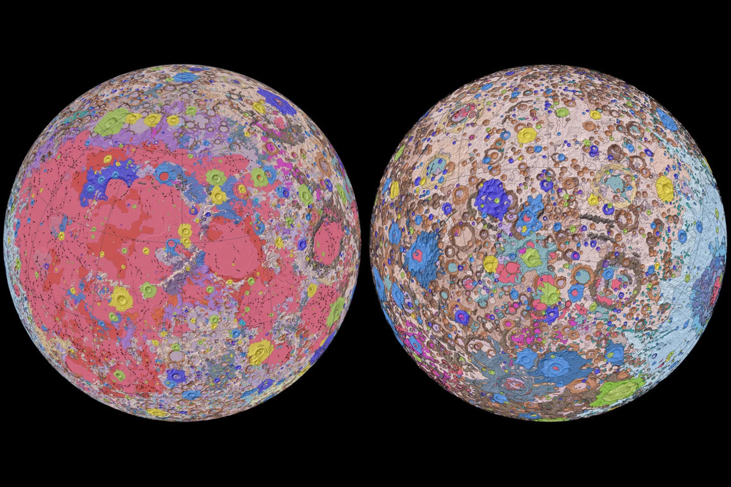
NASA's ambitious plans to land humans on the Moon by 2024 just got one step closer to becoming a reality thanks to the first comprehensive map of our satellite's surface. Unveiled on April 23, 2020, the colorful 1:5,000,000-scale "Unified Geologic Map of the Moon" is the result of decades of painstaking work by scientists from the United States Geological Survey (USGS), NASA, and the Lunar and Planetary Institute.
"People have always been fascinated by the moon and when we might return," said current USGS Director and former NASA astronaut Jim Reilly. "So, it's wonderful to see USGS create a resource that can help NASA with their planning for future missions."
To create the digital map, the researchers drew upon information from the localized maps made during the six Apollo manned missions, as well as more recent data collected by satellite lunar missions. These include stereo observations of the Moon's equatorial region by the Terrain Camera on the recent SELENE (Selenological and Engineering Explorer) mission led by the Japan Aerospace Exploration Agency, as well as the topography data of the Moon's north and south poles obtained by NASA's Lunar Orbiter Laser Altimeter.

The cartographers began by redrawing the historical maps and aligning them with the current updated information. This allowed them to preserve previous observations and interpretations. Once the data had been merged, the USGS researchers created a consistent description of the various rocks, craters, and other exciting geological features that adorn our 4.5 billion-year-old satellite. This helped streamline the conflicting rock names, descriptions, and ages outlined in the various area maps created over the years. Each geological feature was carefully color-coded to enable scientists to easily recognize similar topography. For example, the bright pink covering a large area of the map represents the impact craters that give the Moon its distinct pockmarked appearance. They are believed to have been created by asteroids that hit the lunar surface during the Imbrian era, some 3.5 billion years ago.
The USGS researchers believe that in addition to being an essential blueprint for NASA astronauts, the lunar map will also prove invaluable for the international scientific community, educators, and the public-at-large.
Resources: www.usgs.gov,cnet.com